
Day trips & escapes
Two days south of Nairobi: the Machakos hills and the Magadi road
A 320-kilometre weekend through the two counties most Nairobi visitors never look at, from Kamba woodcarvers and a granite climbing crag to a million-year-old hand-axe site and a soda lake at 38°C.
The case for going south
Everyone leaving Nairobi turns north to Mount Kenya or west to Naivasha. South and southeast is the country nobody photographs: the Athi plains, the Machakos hills rising green out of dry acacia scrub, and then the long tarmac drop down the Magadi road into the Rift floor, where the temperature climbs 15°C in 60 kilometres. It is cheap, it is empty, and both days are entirely doable in a saloon car with decent clearance.
The two days work as a rough figure of eight. Day one goes southeast on Mombasa Road to Athi River, up to Machakos and out to the Kamba carving villages, sleeping in Machakos town. Day two returns west across to the Magadi road via Kitengela and Kiserian, drops to Olorgesailie and Lake Magadi, and climbs back to Nairobi through Ngong. Total driving is about 320 kilometres. Fuel at roughly KSh180-195 a litre puts the whole weekend's petrol at KSh5,500-7,000 for a small car.
Day 1, 7.30am: Lukenya's granite
Leave Nairobi on Mombasa Road early — the Expressway costs KSh120-360 by section and saves 20-30 minutes to the Athi River end — and turn off at Lukenya, about 35 kilometres out. The Lukenya hills are a line of grey granite crags above the plains and they are Kenya's oldest sport-climbing venue, with bolted routes from beginner grades upward and local clubs out most weekends. Even without a rope, the walk up to the base takes 40 minutes and delivers a view over the Athi plains to Ol Donyo Sabuk.
There is game on the ranch land below — giraffe, zebra, eland, the odd hyena — and it is entirely free to look at from the track. Pack your own water; there is nothing to buy up here. If you have a climbing contact in Nairobi, arrange to join a group in advance; if not, treat this as a one-hour leg-stretch and be back in the car by 9.30am. From Lukenya it is 30 kilometres and 40 minutes northeast to Machakos on the Athi River road.
Day 1, 10.30am: Machakos town and the People's Park
Machakos — Masaku to everyone who lives there — was the first colonial administrative centre in what became Kenya, established in 1889, ten years before Nairobi existed. That history has left almost nothing standing, but the town has energy: a huge open-air market on Wednesdays and Saturdays, a bus stage where matatus run to half of eastern Kenya, and good, cheap Kamba food. Eat an early lunch of goat stew, ugali and kienyeji greens in a town canteen for KSh400-800, or grilled meat for KSh1,200 a kilo.
The Machakos People's Park on the edge of town is the county's flagship: 100-odd acres of lawns, a lake with paddle boats, an amphitheatre and a fountain, built at considerable expense and genuinely well used at weekends by families from all over the county. Walking in is free or a nominal charge, with boats and rides at KSh100-300 each. It is not a sight in the tourist sense; it is a good hour of watching what a Kenyan county capital does with its Sunday.
Day 1, 1.30pm: Wamunyu carvers and the hills
Drive 50 kilometres east on the Kitui road to Wamunyu, the village where Kenya's entire woodcarving industry began — Mutisya Munge brought the craft back from service in the First World War and taught it here, and the carvings sold in every Maasai market and airport shop in the country trace back to this one place. The cooperative workshops let you watch carvers working ebony and neem with an adze, and buying direct costs a third of Nairobi prices: a good salad-servers set at KSh600-1,000, a large figure KSh3,000-8,000.
Come back west and spend the last two hours of light in the Mua and Iveti hills above Machakos, where the road climbs to about 1,900 metres through terraced smallholdings and eucalyptus. There is a mission church and a viewpoint on the Iveti ridge looking north across the Athi plains to Nairobi's skyline 60 kilometres away, which at 6pm is the best thing in the county. Sleep in Machakos town: the business hotels around the town centre run KSh3,000-6,500 with breakfast and parking; the hillside country hotels on the Wote road are KSh7,000-12,000.
Day 2, 7am: across to the Magadi road
Leave early — you want to be on the Rift floor before it gets truly hot. Drive back through Athi River and Kitengela, cross to Kiserian on the Isinya road, and pick up the Magadi road heading south, about 70 kilometres and 100 minutes from Machakos. Fill the tank at Kiserian or Ongata Rongai; fuel south of there is unreliable and you will want a full tank for a 220-kilometre round trip with no shade. Carry four litres of water per person and do not rely on phone signal past Olorgesailie.
The Magadi road itself is the attraction for the first hour: good tarmac dropping off the Rift shoulder through Maasai grazing country, with the escarpment wall on your right and the plains opening out ahead. Livestock on the road is constant, so hold 60-70 km/h and expect to brake for goats. Kitengela's glass workshop, on a rough side track off this route, is worth a detour of 30 minutes if the road is dry — the recycled-glass studios sell bowls and beads from KSh500.
Day 2, 9.30am: Olorgesailie's hand axes
Olorgesailie prehistoric site sits 65 kilometres down the Magadi road, at the bottom of a hot, pale valley, and it is one of the most significant Acheulean sites on earth: a lake bed where Homo erectus butchered animals between 1.2 million and 500,000 years ago, excavated by Mary and Louis Leakey from 1942. Entry to the National Museums site runs a few hundred shillings for citizens and roughly KSh1,000-1,500 for non-residents, with a compulsory guide included.
What makes it extraordinary is that the hand axes are still lying where they were dropped, under shelters on the excavated surfaces — hundreds of worked stones, plus the fossil bones of extinct elephant and hippo species, in situ rather than in a case. Give it 90 minutes. The site has simple bandas and a campsite at around KSh1,500-3,000 a person if you want to stay out, which is worth considering for the night sky; there is no other accommodation for 50 kilometres in any direction.
Day 2, midday: Lake Magadi, then home over Ngong
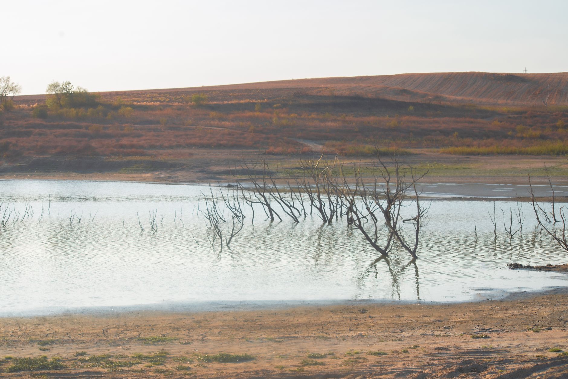
Another 45 kilometres south brings you to Lake Magadi at 600 metres, the lowest and hottest place within easy reach of Nairobi: a soda lake crusted pink and white with trona, worked by the soda ash plant that built the town, with flamingos on the brine and hot springs bubbling out at the southern end at temperatures you cannot put a hand in. Expect 35-40°C at midday and a permit charge of KSh500-1,000 to cross the causeway. Go early, drink constantly, and do not walk on the crust.
Turn for home by 2pm. It is 110 kilometres and about two and a half hours back up the Magadi road to Kiserian, and the climb out of the Rift in the afternoon light is the best driving of the weekend. Finish with an hour on the Ngong Hills ridge if legs allow — Kenya Forest Service entry is roughly KSh200 for citizens and KSh600 for non-residents, a ranger escort is strongly advised at KSh1,000-2,000, and the wind turbines and the drop into the Rift make a proper full stop. Sleep in Karen or Kilimani, KSh7,000-20,000.
Questions, answered
Do I need a 4WD for this weekend?
No, if you stay on tarmac — Mombasa Road, the Machakos and Wamunyu roads and the Magadi road are all sealed. You need clearance and preferably 4WD for the Lukenya approach track, the Kitengela glass studio turn-off and anything at Olorgesailie beyond the car park, and all three become impassable in a saloon after heavy rain.
How hot does the Magadi day get?
Lake Magadi routinely hits 35-40°C between 11am and 3pm, against 22-25°C in Nairobi the same day, because you have dropped from 1,795 metres to about 600. Carry four litres of water per person, keep the car's coolant topped up, and plan to be at the lake by 11am and heading back up by 2pm.
Which months suit this route?
June to September and January to February. The Rift floor is unbearable in the hot months either side of the rains, and the Machakos hill roads and the Olorgesailie tracks get greasy in April, May and November. July gives you cool Machakos mornings at 14-16°C and a Magadi day that tops out nearer 33°C.
Can it be done without a car?
Machakos, yes — matatus run from the Machakos Country Bus stage in Nairobi every few minutes for KSh200-350, an hour and a half each way, and local matatus reach Wamunyu. Magadi is harder: infrequent buses from Kiserian take three hours and leave you stranded on timings. For day two, hire a car with a driver at KSh8,000-12,000.
Doing good is the business: every booking through Stay Nairobi funds one verified tonne of carbon removal — same room, same price, no markup.
Start your search